Industrial
Advanced inspections and high-precision data acquisition.
Aerial technology for reliable analysis and informed decision-making.
Drone inspections allow you to analyze complex infrastructures, systems, and environments quickly, safely, and in great detail.
Through advanced sensors and integrated surveying techniques, it is possible to acquire accurate data even in difficult-to-access areas, reducing operating times and risks for personnel.
The integration of high-resolution images, thermal data, and 3D models allows for the identification of anomalies, monitoring of structural health, and planning of targeted interventions. This approach enables more efficient asset management and supports predictive maintenance strategies.
INSPECTION
Surveys and data acquisition
Acquisition of high-resolution RGB, multispectral, and thermal images for the creation of orthophotos, digital models, and georeferenced maps.
Analysis and modeling
Data processing to generate 3D models, point clouds, and output compatible with CAD, GIS, and BIM systems.
Technical inspections
Visual and thermographic inspections of infrastructure, industrial plants, and power lines, with precise identification of critical issues and anomalies.
Data management and integration
Organization and georeferencing of collected information, ready for advanced analysis and use in business workflows.

ENERGY
The use of drones for energy monitoring allows for the analysis of photovoltaic systems and electrical infrastructures with speed, precision, and operational continuity.
Thanks to thermal and visual sensors, it is possible to promptly identify anomalies, efficiency losses, and structural issues, improving system performance and reducing maintenance costs. The acquired data is processed and transformed into operational information, supporting strategic decisions and targeted interventions through digital systems and GIS platforms.
Workflow
01 — Data acquisition
Complete system survey using RGB and thermal sensors, with optimized photogrammetric coverage to reduce operating times.
02 — Analysis and processing
Generation of visual and thermal orthophotos, with automated analysis to identify anomalies and inefficiencies.
03 — Identification of critical issues
Classification of anomalies through radiometric analysis, with precise identification of critical points and level of severity.
04 — Reports and data management
Production of technical reports and integration into GIS platforms for consultation, monitoring, and continuous updating of systems.
.png)
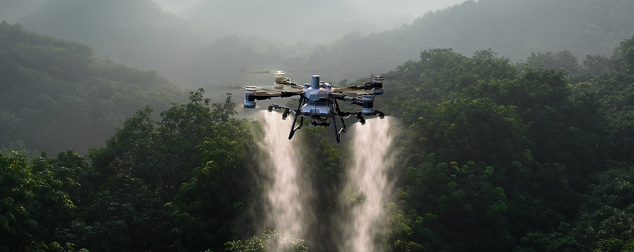
PRECISION FARMING
The use of drones in agriculture allows for crop and soil monitoring with a high level of detail and in a short time. Through advanced sensors and multispectral surveys, it is possible to analyze the vegetative state, identify water or nutritional stress, and intervene in a targeted manner.
Data acquisition and processing allow for the optimization of resource use such as water, fertilizers, and pesticides, improving yields and reducing waste. This approach supports more informed decisions and more sustainable and efficient agricultural management.