
Advanced Remote Sensing and Innovative Inspections
With our young and passionate team, we offer a variety of high-quality remote sensing services:
High Resolution Surveys : Our drones, equipped with RGB, multispectral and thermal sensors, capture detailed images. We create precise maps and colorful orthophotos to give you a clear view of your environment.
Design and Planning : From environmental monitoring to infrastructure design, our expert team develops integrated CAD and GIS documents, optimizing time and costs to translate your vision into reality.
Creative Data Analysis : We leverage our expertise in data analysis to develop digital terrain models and offer creative solutions tailored to your needs.
Specialized Services: From disaster mitigation to volumetric monitoring of landfills, we offer a full range of specialized services. Count on us for metric calculations and precise map updates.

The Future is Now, the Vision is 3D
Topographic Surveys and 3D Models: We use advanced topographic survey tools to refine 3D models, creating the perfect basis for
your three-dimensional vision.
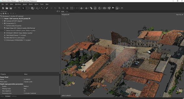
Drone Photogrammetry: Our drone photogrammetry captures detailed images, resulting in textured 3D models that turn your ideas into tangible reality.
Terrestrial Laser Scanner Surveys : With precision laser technology, we acquire data for point clouds and meshes, fundamental for BIM modeling and the creation of extraordinary virtual environments.
Point Clouds and Meshes BIM: The essential basis for Building Information Modeling (BIM), creating detailed and functional digital structures.
BIM modeling: Advanced approach to design, we guarantee BIM models that reflect three-dimensional reality, offering you a clear and complete vision.
Textured 3D Models and Realistic Renderings: Bring your designs to life with textured, detailed, and mesmerizing 3D models. We bring your vision to life with renderings that capture the essence of your projects.

Vision Beyond the Ordinary
We explore the future with advanced visual and thermographic inspections to monitor infrastructure and power lines. Our services include:
4K Video and High Resolution Images: We capture every detail with cutting-edge drones and sensors, providing 4K video and ultra-high resolution images.
Punctual Inspections with Different Drones and Sensors: We use different types of drones and sensors for targeted inspections, guaranteeing a detailed assessment of the structural and functional integrity.
Real Time Video Transmission: Thanks to real-time video transmission systems , the operator on the ground can carry out an initial evaluation directly in the field or remotely via live streaming.
Georeferencing and Data Organization: The data is georeferenced and organized according to standards agreed with the Client, optimizing further analysis processes in the office.
.png)


